n??vi?? 2405/2505 series
owner???s manual
models: 2405, 2415, 2445, 2455, 2475, 2495, 2515, 2545, 2555, 2565, 2595
n??vi?? 2405/2505 series
owner???s manual
models: 2405, 2415, 2445, 2455, 2475, 2495, 2515, 2545, 2555, 2565, 2595
?? 2011 Garmin Ltd. or its subsidiaries
All rights reserved. Except as expressly provided herein, no part of this manual may be reproduced, copied, transmitted, disseminated, downloaded or stored in any storage medium, for any purpose without the express prior written consent of Garmin. Garmin hereby grants permission to download a single copy of this manual onto a hard drive or other electronic storage medium to be viewed and to print one copy of this manual or of any revision hereto, provided that such electronic or printed copy of this manual must contain the complete text of this copyright notice and provided further that any unauthorized commercial distribution of this manual or any revision hereto is strictly prohibited.
Information in this document is subject to change without notice. Garmin reserves the right to change or improve its products and to make changes in the content without obligation to notify any person or organization of such changes or improvements. Go to the Garmin Web site (www.garmin.com) for current updates and supplemental information concerning the use and operation of this and other Garmin products.

Table of Contents
Getting Started??????????????????????????????????????????????????????????????????????????????????????????????????????????????????????????? 1
Finding Locations???????????????????????????????????????????????????????????????????????????????????????????????????????????? 8
Voice Command??????????????????????????????????????????????????????????????????????????????????????????????????????????????? 18
Navigation ?????????????????????????????????????????????????????????????????????????????????????????????????????????????????????????????????????????? 21
Map Pages?????????????????????????????????????????????????????????????????????????????????????????????????????????????????????????????????????????? 26

Using the Apps ?????????????????????????????????????????????????????????????????????????????????????????????????????????????????? 34
Traffic?????????????????????????????????????????????????????????????????????????????????????????????????????????????????????????????????????????????????????????????????? 45
Data Management?????????????????????????????????????????????????????????????????????????????????????????????????????? 50
Customizing the Device???????????????????????????????????????????????????????????????????????? 51
Appendix ???????????????????????????????????????????????????????????????????????????????????????????????????????????????????????????????????????????????? 57

Index ????????????????????????????????????????????????????????????????????????????????????????????????????????????????????????????????????????????????????????????????????? 65

Getting Started
??? WARNING
See the Important Safety and Product Information guide in the product box for product warnings and other important information.
1Connect the device to vehicle power (page 1).
2 Mount the device (page 1).
3 Register the device (page 3).
4Check for updates.
???Software updates (page 3).
???Free map update (page 3).
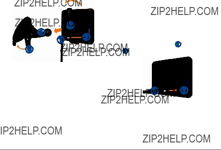
Connecting the Device to Vehicle Power
??? WARNING
This product contains a
Before you use your device on battery power, you should charge it.
1Plug the vehicle power cable ??? into the USB port on the device ???.
2 Snap the mount ??? onto the suction cup ???.
3Press the suction cup to the windshield, and flip the lever ??? back toward the windshield.
4 Fit the bottom of your device into the mount. 5 Tilt your device back until it snaps into place.
???
??? ??? ???
???
6Plug the other end of the vehicle power cable into a power outlet in your vehicle.
7If necessary, connect the external antenna to the traffic receiver and secure it to the windshield using the suction cups.
About myDashboard
Use myDashboard to register your device, check for software and map updates, access product manuals and support, and more.
Setting Up myDashboard
1Connect the USB cable ??? to the USB port ??? on the device.
??????
2Connect the USB cable to the USB port on your computer.
3 Go to www.garmin.com/dashboard.
4 Follow the

Registering the Device
1 Open myDashboard (page 2).
2 Follow the
Updating the Software
1 Open myDashboard (page 2).
2 Under Software Updates, click Update Now.
3 Follow the
n??Maps Guarantee???
If you register through myDashboard, your device could be eligible for one free map update within 90 days of first acquiring satellites while you drive. Go to www.garmin.com/numaps for details and terms and conditions.
Updating Maps
1 Open myDashboard (page 2).
2 Register the device (page 3).
3 Under Map Updates, click Update Now.
4 Follow the
Turning Off the Device
You can power off the device completely. 1 Hold the Power key ??? for 3 seconds.
???
NOTE: If you hold the Power key for less than 3 seconds, the device enters sleep mode (page 4).
2 Select Off.

Resetting the Device
You can reset your device if it stops functioning. Hold the Power key for 10 seconds.
About Sleep Mode
Use sleep mode to conserve battery power when your device is not in use. Sleep mode uses very little power, and a battery charge lasts for weeks when your device is in sleep mode.
Entering Sleep Mode
Press the Power key.
Exiting Sleep Mode
While the device is in sleep mode, Press the power key and  .
.
Adjusting the Screen Brightness
1 Select Settings > Display > Brightness.
2 Use the slider bar to adjust the brightness.
Adjusting the Volume
1 Select Volume.
2Select an option:
???Use the slider bar to adjust the volume.
???Select  to mute the device.
???Select  > Audio Mixer and use the slider bars to adjust the volume for navigation prompts, phone, and media.
About Automatic Volume
NOTE: Automatic volume is not available on all models.
Your device can increase or decrease the volume automatically based on the level of background noise.
Enabling Automatic Volume
1 Select Volume >  > Automatic Volume.
2 Select Enabled.
Status Bar Icons
The status bar is located at the top of the main menu. The status bar icons display information about features on the device. You can select some icons to change settings or view additional information.
GPS signal status.
Bluetooth?? technology status (appears when Bluetooth is enabled). See (page 30)
Transportation mode indicator. Current time.
Battery status.
Satellite Signals
After the device is turned on, it begins acquiring satellite signals. The device may need a clear view of the sky to acquire satellite signals. When at least one of the  bars is green, your device has acquired satellite signals.
For more information about GPS, go to www.garmin.com/aboutGPS.
Viewing GPS Signal Status
Hold  for three seconds.
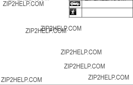
Transportation Modes
Automobile mode
Pedestrian mode
Routing and navigation are calculated differently based on your transportation mode.
For example, in Automobile mode, the estimated time of arrival is calculated using the speed
limit of the roads on the route. Pedestrian mode calculates time of arrival based on walking speed.
NOTE: Pedestrian routes do not include highways. If you have cityXplorer??? maps loaded on your device, pedestrian routes may include public transit (page 25).
Choosing a Transportation Mode
Select  or
or  .
.

Battery Information
After the device is connected to power, it begins to charge.
 in the status bar indicates the status of the internal battery. To increase the accuracy of the battery gauge, you should fully discharge the battery and then fully charge it. Do not unplug the device until it is fully charged.
Using the
???Select  to return to the previous screen.
???Hold  to quickly return to the main menu.
???Select  or
or  to see more choices.
???Hold  or
or  to scroll faster.
???Select  to see a menu of options for the current screen.
Using the
See ???Language and Keyboard Settings??? to change the keyboard layout (page 56).
???Select a character on the keyboard to enter a letter or number.
???Select  to add a space.
???Select  to delete an entry.
???Select  to delete a character.
???Select  to enter special characters, such as punctuation marks.
???Select  to change character capitalization.

About Shortcuts
You can add shortcuts to the Where To? menu. A shortcut can point to a location, a category, or a search tool.
Adding a Shortcut Icon
The Where To? menu can contain up to 36 shortcut icons.
1 Select Where To? > Add Shortcut.
2 Select an item.
Removing a Shortcut
1Select Where To >  > Remove Shortcut(s).
2 Select the shortcut to remove.
3 Select the shortcut again to confirm.
Finding Locations
The device offers many methods for finding locations.
???By category (page 9)
???Near another location (page 10)
???By spelling the name (page 11)
???By address (page 11)
???Using the map (page 13)
???Using recently found locations (page 14)
???Using coordinates (page 12)
???Using photos (page 15)
???Using saved locations (page 16)

About Locations
The detailed maps loaded in your device contain locations, such as restaurants, hotels, and auto services. You can use the Categories function to browse for nearby businesses and attractions.
Finding a Location by Category 1 2 3 4
Searching Within a Category
To narrow your search results, you can search within some categories.
1 Select Where To?.
2 Select a category, or select Categories.
3 If necessary, select a subcategory.
4 Select the search bar ???.
???
5 Enter all or part of the name.
6 Select  .
.
Finding a Location Using the Search Bar
You can use the search bar to search for locations by entering a category, brand name, address, or city name.
1 Select Where To?.
2 Select the search bar.
3Enter a search term.
Suggested search terms appear below the search bar as you type.
???To search for a type of business, enter a category name, such as ???movie theaters??? or ???coffee shops.???

???To search for a business by name, enter all or part of the name.
???To search for an address near you, enter the street number and street name.
???To search for an address in another city, enter the street number, street name, city, and state.
???To search for a city, enter the city and state.
???To search for coordinates, enter latitude and longitude coordinates.
4Select an option:
???To search using a suggested search term, select the term.
???To search using the text you entered, select  .
.
5 If necessary, select a location.
Changing the Search Area
By default, your device finds locations closest to your current location. You can find a location near another city or location.
1 Select Where To? > Searching Near.
2 Select an option.
3 If necessary, select a location.
Reporting a Closed or Missing Location
If your search results include an outdated or incorrect location, you can report the error to Garmin and remove the location from future searches.
1 Find a location (page 8).
2 Select a location from the list.
3 Select  .
.
4 Select  > Edit.
5Select Report as Closed or Report as Missing.

This information is sent to Garmin when you connect your device to myGarmin??? using your computer.
Editing Location Information
You can change the address or phone number for a location that appears in the search results.
1 Find a location (page 8).
2 Select a location from the list.
3 Select  .
.
4 Select  > Edit.
5Select Address or Phone Number, and enter the new information.
Rating a Point of Interest
You can assign a star rating to a point of interest.
1 Find a location (page 8).
2 Select  >
>  .
.
3 Select the stars to rate the point of interest.
The star rating updates on your device.
About Search Tools
Search tools allow you to search for cities, addresses, intersections, or coordinates. By default, the address search tool appears in the Where To? menu. To search for cities, intersections, and coordinates, you must add those search tools to the Where To? menu (page 8).
Finding an Address
NOTE: The order of the steps may change depending on the map data loaded on your device.
1 Select Where To? > Address.
2Enter information as prompted by the on- screen instructions.
3If necessary, select Searching Near, and enter a different city or postal code.

4 If necessary, select the address.
Finding a City
Before you can find a city, you must add the city search tool to the Where To? menu (page 8).
1 Select Where To? > Cities.
2 Select Enter Search.
3 Enter a city name, and select  .
.
4 Select a city.
Finding an Intersection
Before you can find an intersection, you must add a shortcut to the intersection search tool (page 8).
1 Select Where To? > Intersections.
2Select a state or province.
NOTE: If necessary, select State or Country to change the country, state, or province.
3 Enter the first street name, and select Next. 4 If necessary, select the street.
5Enter the second street name, and select
Next.
6 If necessary, select the street.
7 If necessary, select the intersection.
Finding a Location Using Coordinates
You can find a location using latitude and longitude coordinates. This method can be helpful when geocaching.
1Select Where To? > Categories > Coordinates.
2If necessary, select  > Format, select the correct coordinate format for the type of map you are using, and select Save.
3 Select the latitude coordinate.
4 Enter the new coordinate, and select Done.
5 Select the longitude coordinate.
6 Enter the new coordinate, and select Done.
7 Select View on Map.

Finding a Location by Browsing the Map
Before you can find places included in the map data, such as restaurants, hospitals, and fuel stations, you must enable the map layer for places along the road (page 26).
1 Select View Map.
2 Select the screen.
3Drag and zoom the map to display the area to search.
Location markers appear on the map for places along the road.
4If necessary, select  , and select a category icon to view only a specific category of places.
5Select an option:
???Select a location marker.
???Select a point, such as a street, intersection, or address location.
6If necessary, select the location description to view additional information.
Finding a Location Using Quick Search
After you have performed a search for a point of interest, certain categories may display a Quick Search list that displays the last four destinations you selected.
1 Select Where To?.
2 Select a category, or select Categories.
3If applicable, select a destination from the Quick Search list.
4If necessary, select the appropriate destination.

Saving a Home Location
You can set your home location for the location you return to most often.
1Select Where To? >  > Set Home Location.
2Select Enter My Address, Use My Current Location, or Recently Found.
The location is saved as ???Home??? in the Saved folder (page 16).
Going Home
Select Where To? > Go Home.
Editing Your Home Location Information
1 Select Where To? > Saved > Home.
2 Select  > Edit.
3 Enter your changes.
4 Select Done.
Finding Recently Found Places
Your device stores the last 50 locations you have found.
1 Select Where To? > Recent.
2 Select a location.
Clearing the List of Recently Found Places
Select Where To? > Recent >  > Clear
> Yes.
Finding Parking
You can find detailed parking information and pricing information.
1 Select Where To? > Categories > Parking.
2 Select an option.
3 Select a parking location.
Using Photo Navigation
You can upload pictures onto your device or memory card that include location information and create routes to the pictured locations.
1Connect your device to your computer (page 50).
2 Go to http://connect.garmin.com/photos.
3Follow the instructions on the Web site to select and load pictures.
4 Disconnect the device from the computer.
5 Turn on the device.
6From the main menu, select Where To? >
Saved > Photos.
A list of pictures with location information appears.
7 Select a picture.
Setting a Simulated Location
If you are indoors or not receiving satellite signals, you can use the GPS to set a simulated location.
1 Select Settings > Navigation.
2 Select GPS Simulator.
3 Select View Map.
4Select an area on the map.
The address of the location appears at the bottom of the screen.
5 Select the address.
6 Select Set Location.

Saving Locations
You can save locations so you can quickly find them and create routes to them.
Saving a Location
1 Find a location (page 9).
2 Select a location from the list.
3 Select  .
.
4 Select  > Save.
5 If necessary, enter a name, and select Done.
Saving Your Current Location
1 From the map, select the vehicle icon.
2 Select Save.
3 Enter a name, and select Done.
4 Select OK.
Starting a Route to a Saved Location 1 Select Where To? > Saved.
2If necessary, select a category, or select All Categories.
3 Select a location.
4 Select Go!.

Editing a Saved Location
1 Select Where To? > Saved.
2 If necessary, select a category.
3 Select a location.
4 Select  .
.
5 Select  > Edit.
6Select an option:
???Select Name.
???Select Phone Number.
???To assign categories to the Favorite, select Categories.
???To save a photo with the Favorite, select
Assign Photo (page 41).
???To change the symbol used to mark the Favorite on a map, select Change Map Symbol.
7 Edit the information.
8 Select Done.
Assigning Categories to a Saved Location
You can add custom categories to organize your saved locations.
NOTE: Categories appear in the saved locations menu after you have saved more than 12 locations.
1 Select Where To? > Saved.
2 Select a location.
3 Select  .
.
4 Select  > Edit > Categories.
5Enter one or more category names, separated by commas.
Suggested categories appear below the text bar as you type. You can select a suggested word to use the suggestion.
6 Select Done.

Deleting a Saved Location
NOTE: Deleted locations cannot be recovered.
1 Select Where To? > Saved.
2 Select  > Delete Saved Places.
3Select the box next to the saved locations to delete, and select Delete.
Voice Command
About Voice Commands
NOTE: Voice Command is not available on all models, or for all languages and regions.
Voice Command allows you to use your device by saying words and commands. The Voice Command menu provides voice prompts and a list of available commands.
Setting your Wakeup Phrase
The wakeup phrase is a word or phrase you can say to activate Voice Command. The default wakeup phrase is Voice Command.
TIP: You can reduce the chance of accidental Voice Command activation by using a strong wakeup phrase.
1Select Apps > Voice Command > Customize Phrase.
2Enter a new wakeup phrase.
The device indicates the strength of the wakeup phrase as you enter the phrase.
3 Select Done.
Activating Voice Command
Say your wakeup phrase.
The Voice Command menu appears.
Voice Command Tips
???Speak in a normal voice directed at the device.
???Reduce background noise, such as voices or the radio, to increase the accuracy of the voice recognition.
???Speak commands as they appear on the screen.
???Respond to voice prompts from the device as needed.
???Increase the length of your wakeup phrase to reduce the chance of accidental Voice Command activation.
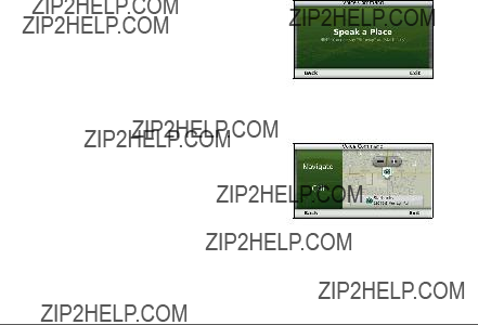
Starting a Route Using Voice Command
You can say the names of popular,
1 Say your wakeup phrase.
2 Say Find Place.
3Listen for the voice prompt, and speak the name of the location.
A list of locations appears.
4 Say the line number.
5 Say Navigate.
Finding an Address
1 Say Voice Command.
2 Say Find Address.
3 Speak the entire address.
Muting Instructions
You can disable the voice prompts for Voice Command without muting the device.
1 Select Apps > Voice Command >  .
.
2 Select Mute Instructions > Enabled.
Disabling Voice Command
You can disable Voice Command, which prevents you from accidentally activating Voice Command while speaking.
1 Select Apps > Voice Command >  .
.
2 Select Voice Command > Disabled.

Navigation
Starting a Route
1 Search for a location (page 8). 2 Select a location.
3 Select Go!.
4If necessary, select an option.
???Select Drive.
???Select Walk.
???Select Public Transit to calculate a route that combines public transit and walking.
NOTE: You must have cityXplorer??? maps loaded to navigate using public transit (page 25).
5 If necessary, select a route.
Starting a Route to a Saved Location 1 Select Where To? > Saved.
2If necessary, select a category, or select All Categories.
3 Select a location.
4 Select Go!.
Using Multiple Route Preview 1 Search for a location.
2 Select a location.
3Select Routes and, if necessary, select Drive (page 9).
A map appears with Faster Time, Shorter Distance, and Less Fuel routes highlighted.
4 Use the

Following an Automobile Route
The route is marked with a magenta line. A checkered flag marks your destination.
As you travel, the device guides you to the destination with voice prompts, arrows on the map, and directions at the top of the map. If you depart from the original route, the device recalculates the route and provides new directions.
Using the Automobile Navigation Map
While navigating in Automobile mode, you can select map features.
1Select the map. Map icons appear.
2Select an option:
???To view different parts of the map, drag the screen.
???To zoom in and out, select  or
or  .
.
???To rotate the map view, select  .
.
???To switch from North Up to 3D view, select .
.
???To add or remove map layers, select
.
???To center the map on your current location in pedestrian mode, select  .
.

Adding a Point to a Route
Before you can add a stop to a route, you must be navigating a route in Automobile mode.
1While navigating a route, select  to return to the main menu.
2 Select Where To?.
3 Search for the location (page 9). 4 Select Go!.
5 Select Add to Active Route.
Taking a Detour
While navigating an automobile route, you can use detours to avoid obstacles ahead of you, such as construction zones.
NOTE: If the route you are currently navigating is the only reasonable option, your device might not calculate a detour.
From the map, select  > Detour.
Stopping the Route
From the map, select  >
>  .
.
About Exit Services
While you navigate a route, you can find gas, food, lodging, and restrooms near upcoming exits.
Services are listed under tabs by category.
Navigating to an Exit
3Select an exit service tab.
??? To view nearby gas stations, select  .
.

???To view nearby restaurants, select  .
.
???To view nearby lodging, select  .
.
???To view nearby restrooms, select  . 4 Select a point of interest.
Avoiding Road Features
1Select Settings > Navigation > Avoidances.
2Select the road features to avoid on your routes, and select Save.
Avoiding Transit Types
NOTE: Transit types are available when cityXplorer maps are loaded (page 25).
1Select Settings > Navigation > Public Transit.
2Select the transit type to avoid on your routes.
3 Select Save.
Navigating Off Road
If you are not following roadways as you navigate, you can use Off Road mode.
1 Select Settings > Navigation.
2Select Calculation Mode > Off Road > Save.
The route will be calculated as a straight line to the location.
Pedestrian Routes
Following a Pedestrian Route
In Pedestrian mode, your route is displayed on a
If you have cityXplorer maps installed, the device calculates a route that uses a
combination of public transit options, such as riding a bus or subway, and walking.
NOTE: cityXplorer maps are not included with the device. See http://my.garmin.com to purchase cityXplorer maps.
NOTE: You can change the types of public transit and limit the distance spent walking during a pedestrian route (page 53).
Using the Pedestrian Navigation Map
???
???
???Select ??? to switch between sections of the route.
???Select ??? to view the route itinerary.
About Map Icons
???When you are navigating in Pedestrian mode,  indicates your approximate position and your direction of travel on the map.
???The circle around  indicates the accuracy of your position on the map. A smaller circle means the displayed position is more accurate.
???The yellow icons indicate the navigation method used in each section of the route.
???The black dots on the map are public transit stops along your route.
Enabling Transit Types
NOTE: Transit types are available when cityXplorer maps are loaded (page 25).
1Select Settings > Navigation > Public Transit.

2Select the transit type to include in your routes, and select Save.
Map Pages
Customizing the Map
Customizing the Map Layers
You can customize which data appear on the map, such as icons for points of interest and road conditions.
1 From the map, select  .
.
2 Select Map Layers.
3Select which layers you want to include on the map, and select Save.
Viewing the Trip Log
Your device keeps a trip log, which is a record of the path you have traveled.
1Select Settings > Map and Vehicle > Map Layers.
2 Select the Trip Log check box.
Changing the Map Data Field
1From the map, select the data field in the lower
2 Select a type of data to display.
3 Select Save.
Changing the Map Perspective
1Select Settings > Map and Vehicle > Driving Map View.
2Select an option:
???Select Track Up to display the map in two dimensions
???Select North Up to display the map in

???Select
Changing the Tools on the Map
Map tools appear as buttons on the map, which provide quick access to device functions. For example, you can add a button to take a detour, adjust the brightness, or view exit services. You can select up to three tools to display on the map.
1From the main menu, select Settings > Map and Vehicle > Map Buttons.
2 Select an option:
???To remove a tool, select the tool, and select Remove.
???To reset to the default tools, select Reset to Defaults.
3 Select Save.
Changing the Map Dashboard
1Select Settings > Map and Vehicle > Dashboards.
2 Use the arrows to select a dashboard.
3 Select Save.
Viewing Turns
Viewing a List of Turns
When you are navigating a route, you can view all of the turns and maneuvers for your entire route and the distance between turns.
1 Select the text bar on the top of the map.

2Select a turn.
The details for the turn appear. If available, an image of the junction appears for junctions on major roadways.
Viewing the Entire Route on the Map
1While navigating an automobile route, select the navigation bar at the top of the map.
2 Select  > Map.
Viewing the Next Turn
While navigating an automobile route, a preview of the next turn, lane change, or other maneuver appears in the
The preview includes the distance to the turn or maneuver and the lane in which you should be traveling, if available.
From the map, select  to view the next turn on the map.
Viewing Junctions
While navigating an automobile route, you can view the junctions on major roadways. When you approach a junction in a route, the image of that junction appears briefly, if available.
From the map, select  to view the junction, if available.

Viewing Traffic Alerts
While you navigate an automobile route, a traffic alert may appear in the navigation bar.
Select the alert to view more information.
Viewing Trip Information
The trip information page displays your present speed and provides statistics about your trip.
TIP: If you make frequent stops, leave the device turned on so it can accurately measure elapsed time during the trip.
From the map, select  > Trip Computer.
Resetting Trip Information
1 From the map, select Speed >  .
.
2Select an option:
???When not navigating a route, select Reset All to reset every data field, except the speedometer, on the page.
???Select Reset Trip Data to reset the information on the trip computer.
???Select Reset Max. Speed to reset the maximum speed.
???Select Reset Trip B to reset the odometer.

Viewing Current Location
Information
Use the Where Am I? page to view information about your current location. This feature is helpful if you need to tell emergency personnel your location.
From the map, select  > Where Am I?.
Finding Nearby Services
1 From the map, select  > Where Am I?.
2Select Hospitals, Police Stations, or Fuel to view the nearest locations in that category.
About
Using Bluetooth?? wireless technology, your device can connect to your mobile phone to become a
Your phone may not support all of the hands- free phone features your device provides.
Enabling Bluetooth Wireless Technology
1 Select Settings > Bluetooth.
2 Select Bluetooth.

Pairing Your Phone
Before you can use
1Place your phone and your device within 33 ft. (10 m) of each other.
2On your device, enable Bluetooth wireless technology (page 30).
3Select an option:
???Select Add Phone.
???If you have already paired a different phone, select Phone >  .
.
4On your phone, enable Bluetooth wireless technology.
5On your device, select OK.
A list of nearby Bluetooth devices appears.
6Select your phone from the list, and select
OK.
7If necessary, on your phone, confirm that the device is allowed to connect.
8If necessary, enter the device Bluetooth PIN (1234) into your phone.
Disconnecting Your Phone
1 Select Settings > Bluetooth.
2 Select Phone > None > Save.
Your phone is disconnected from your device but remains paired with your device.
Tips After Pairing the Devices
???After the initial pairing, the two devices can connect automatically each time you turn them on.
???When your phone is connected to your device, you can make phone calls.

???When you turn on the device, it tries to connect to the last phone to which it was connected.
???You might have to set your mobile phone to connect to the device automatically when it is turned on.
Receiving a Call
When you receive a call, select an option:
???Select Answer.
???Select Ignore to ignore the call.
Placing a Call
Dialing a Number
1 Select Phone > Dial.
2 Enter the number.
3 Select Dial.
Calling a Contact in Your in your Phone Book
Your phone book is loaded from your phone to the device each time your phone and the device connect. It may take a few minutes for the phone book to be available. Some phones do not support this feature.
1 Select Phone > Phone Book.
2 Select a contact.
3 Select Call.
Calling a Point of Interest 1 2 3

Using the Call History
Your call history is loaded from your phone to the device each time your phone and the device connect. It may take a few minutes for the call history to be available. Some phones do not support this feature.
1 Select Phone > Call History.
2Select a category.
A list of calls appears, with the most recent calls at the top.
3 Select a call.
Using
2Select an option:
???To transfer audio to your phone, select
Handset.
TIP: You can use this feature if you want to turn off your device and remain on the call, or if you need privacy.
???To display a keypad, select Keypad.
TIP: You can use this feature to use automated systems, such as voice mail.
???To mute the microphone, select Mute.
???To hang up, select End Call.

Saving a Home Phone Number
TIP: After you save a home number, you can edit the home number by editing ???Home??? in Saved (page 16).
Select Phone >  > Set Home Number, enter your phone number, and select Done.
Calling Home
Before you can call home using the Call Home button, you must enter a phone number for your home location.
Select Phone > Call Home.
Using the Apps
Using Help
Select Apps > Help to view information about using the device.
Searching Help Topics
Select Apps > Help >  .
.
About ecoRoute
The ecoRoute??? feature calculates the fuel economy and the fuel price of navigating to a destination, and offers tools for improving fuel efficiency.
The data provided by the ecoRoute feature is an estimate only. The data is not actually read from the vehicle, unless you are using the ecoRoute HD accessory. To receive
ecoRoute HD Accessory
When connected to the ecoRoute HD accessory, your device can receive
Go to www.garmin.com/ecoroute for compatibility and purchasing information.
Setting up the Vehicle Profile
The first time you use the ecoRoute features, you must enter vehicle information.
1 Select Apps > ecoRoute???.
2 Enter fuel and mileage information.
Changing the Fuel Price
1 Select Apps > ecoRoute??? > At the Pump.
2Enter the current price of fuel, and select
Next.
3 Select Yes.
Calibrating the Fuel Economy
You can calibrate the fuel economy to receive
1 Select Apps > ecoRoute??? > At the Pump.
2 Enter the current fuel price.
3Enter the amount of fuel the vehicle has used since the last time the fuel tank was filled.
4Enter the distance you have travelled since the last time the fuel tank was filled.
5Select Next.
The device calculates the average vehicle fuel economy.
6 Select Save.

About the ecoChallenge
ecoChallenge helps you maximize the vehicle fuel economy by scoring your driving habits. The higher your ecoChallenge scores, the more fuel you have saved. The ecoChallenge collects data and calculates a score whenever your device is moving and in Automobile mode.
Viewing ecoChallenge Scores
???View your current score in the  ecoChallenge icon on the map.
???Select  to view detailed scores.
About the ecoChallenge Score
???
???
???
???
???
Removing the ecoChallenge Score From the Map
Select  >
>  > Settings > Hide > Save.
Resetting the ecoChallenge Scores
1 Select Apps > ecoRoute > Vehicle Profile.
2 Select Reset.

Viewing Fuel Economy Information
You can view your fuel consumption, your total fuel cost, and your average fuel economy.
1 Select Apps > ecoRoute > Fuel Economy.
2 Select a section of the graph to zoom in.
Mileage Reports
Mileage reports provide the distance, the time, the average fuel economy, and the fuel cost of navigating to a destination.
A mileage report is created for every route that you drive. If you stop a route on the device, a mileage report is created for the distance you traveled.
Viewing a Mileage Report
You can view saved mileage reports on the device.
TIP: You can access mileage reports in the Reports folder on the device drive or volume (page 50).
1Select Apps > ecoRoute??? > Mileage Report.
2 Select a report.
Resetting ecoRoute Information
1Select Apps > ecoRoute??? > Vehicle Profile.
2 Select  > Reset.

About Audiobooks
The device can play audiobooks from Audible. com. This feature requires a subscription to Audible.com. Go to www.audible.com/garmin to activate a free
Loading Audiobooks onto Your Device
Before you can load audiobooks onto your device, you must subscribe to Audible.com. Go to www.audible.com/garmin for more information.
1Connect your device to your computer (page 2).
2On your computer, log in your Audible.com account.
3 Follow the instructions from Audible.com.
Playing an Audiobook
1 Select Apps > Audible.
2 Select Browse.
3Select an option:
???Select Titles.
???Select Authors.
???Select Narrators.
4 Select a book.
5 Select an option to control playback.
???To add a bookmark, select  .
.
???To pause playback, select  .
.
???To resume playback, select  .
.
???To move quickly forward or backward in the book, use the slider bar at the top of the page.
???To go to the next chapter, select  .
.
???To go to the previous chapter, select  .
.
???To fast forward, hold  .
.
???To rewind, hold  .
.
Adding a Bookmark
When you play an audiobook, the player automatically resumes the audiobook from the point where you last stopped. You can add a bookmark to mark a certain spot in the audiobook.
While playing an audiobook, select  > Add Bookmark.
Resuming Playback from a Bookmark 1 While playing an audiobook, select  .
.
2 Select a bookmark.
Renaming a Bookmark
By default, the device names a bookmark using the time stamp of the bookmark. You can rename a bookmark.

Navigating to a Saved Trip 1 Select Apps > Trip Planner.
2 Select a saved trip.
3 Select Go!.
4 If prompted, select a route (page 21).
Editing a Saved Trip
1 Select Apps > Trip Planner.
2 Select a saved trip.
3 Select  .
.
4Select an option:
???Select Rename Trip.
???Select Edit Destinations to add and delete locations, or to change the order of locations.
???Select Delete Trip.
???Select Optimize Order to arrange the stops on your trip in the
Viewing Pictures
View pictures that you have stored in the device or on a memory card. See (page 50) for more information about loading pictures on the device.
1 Select Apps > Picture Viewer.
2 Use the arrows to scroll through the images.
3 Select a picture.
Viewing a Slideshow
1 Select Apps > Picture Viewer.
2Select  .
.
While a slideshow is playing, you can select the screen to stop the slideshow.
Setting a Picture as Wallpaper 1 Select Apps > Picture Viewer.
2 Select a picture.
3 Select  > Set as Wallpaper.

4Use the
5 Select Save.
Deleting Pictures
1 Select Apps > Picture Viewer.
2 Select a picture.
3 Select 
Viewing Previous Routes and
Destinations
Before you can use this feature, you must enable the travel history feature (page 57).
Your can view your previous routes and places you have stopped on the map.
Select Apps > Where I???ve Been.
Using the World Clock
1 Select Apps > World Clock.
2If necessary, select a city, enter a city name, and select Done.
Viewing the World Map
Select Apps > World Clock >  .
.
Nighttime hours appear in the shaded area of the map.
Finding Your Last Parking Spot
When you remove your device from the vehicle mount while the device is on, your current location is saved as a parking spot.
Select Apps > Last Spot.
Using the Calculator
Select Apps > Calculator.

Converting Units
1 Select Apps > Unit Converter.
2If necessary, select the button next to Convert, select a measurement category, and select Save.
3If necessary, select a unit button, select a unit of measurement, and select Save.
4Select the field below the unit you want to convert.
5 Enter the number, and select Done.
Setting Currency Conversion Rates
Manually
You can update the currency conversion rates manually so that you are always using the most- current rates.
1 Select Apps > Unit Converter.
2 Select the button next to Convert.
3 Select Currency, then select Save.
4If necessary, select a currency button, select a different currency, and select Save.
5Select the button at the bottom of the screen that displays the currency conversion rate.
6 Select the box next to a currency.
7 Enter a value, and select Done.
8 Select OK.
About Offers
If your device package includes a traffic receiver, you will receive
NOTE: The traffic receiver must be connected to external power and you must be in a coverage area to receive
See our privacy statement at www
.garmin.com/privacy/ to view our privacy information.

Viewing Offers
??? CAUTION
Do not attempt to write down the coupon codes while driving.
1Select an offer that appears on the screen to search for the nearest location related to that offer.
2If available, select  to view a coupon code.
3Write down this code and present it when you arrive at the location.
Viewing an Offer List
Select Apps > Offers to view a list of the offers you have received.
Disabling Traffic and Offers
To disable offers, you must disable traffic.
1 Select Settings > Traffic.
2 Select the Live Traffic check box.
Using the Language Guide
Use the Language Guide to look up and translate words or phrases.
Select Apps > Language Guide.
Selecting Languages in a Language
Guide
You can select the languages you want to translate when translating words and phrases.
1Select Apps > Language Guide > Words and Phrases.
2 Select  > Language.
3Select From, select the language to translate from, and select Save.
4Select To, select the language to translate to, and select Save.
Translating Words and Phrases
1Select Apps > Language Guide > Words and Phrases.
2 Select a category and subcategories.
3If necessary, select  , enter a keyword, and select Done.
4 Select a word or a phrase.
5 Select  to listen to the translation.
Using the Bilingual Dictionary
1Select Apps > Language Guide > Bilingual Dictionaries.
2 Select a dictionary.
3If necessary, select  , enter a word, and select Done.
4 Select a word.
5 Select  to listen to the translation.
Traffic
NOTICE
Garmin is not responsible for the accuracy or timeliness of the traffic information.
Traffic information may not be available in all areas or countries.
A traffic receiver is included in some packages, and is an optional accessory for all models. It is built into the vehicle power cable. The powered traffic receiver and the device must be in data range of a station transmitting traffic data to receive traffic information. You do not need to activate the subscription included with your traffic receiver.
For information about traffic receivers and coverage areas, go to www.garmin.com/traffic.
Disabling Live Traffic
1 Select Settings.
2 Clear the Live Traffic check box.
The device no longer receives live traffic data, but automobile routes still avoid potentially congested areas using trafficTrends, if enabled (page 55).
Traffic Data
When the receiver is within a traffic coverage area, your device will begin displaying traffic information.
The traffic receiver and the device may need to be in data range of an FM station transmitting traffic information.
1Connect the traffic receiver to an external power source.
2 Connect the traffic receiver to the device.
NOTE: Heated (metallized) windshields could degrade the performance of the traffic receiver.
Traffic Receiver
??? ???
??? ??? ???
???
???External antenna connector
???Internal antenna
???Power LED
???Vehicle power adapter

About the Traffic Icon
When you are receiving traffic information, a traffic icon appears on the map. The traffic icon changes color to indicate the severity of traffic conditions.
Traffic on Your Route
When calculating your route, the device examines the current traffic and automatically optimizes the route for the shortest time. If a severe traffic delay occurs on your route while you are navigating, your device automatically recalculates the route.
The traffic icon changes color to indicate the severity of traffic conditions on your route or on the road you are currently traveling.
Your device may route you through a traffic delay if a better alternative route does not exist. The delay time is added into your estimated time of arrival automatically.
Viewing Traffic on Your Route
1 While navigating a route, select  .
.
2Select Traffic on Route.
A list of traffic events appears, organized by their location on the route.

3 Select an event.
Manually Avoiding Traffic on Your Route 1 From the map, select  .
.
2 Select Traffic On Route.
3If necessary, use the arrows to view other traffic delays on your route.
4 Select  > Avoid.
Taking an Alternate Route
1While navigating an automobile route, select  .
.
2 Select Alternate Route.
3 Select a route.
Viewing Traffic on the Map
The traffic map shows
1 From the map, select  .
.
2 Select Traffic Conditions.
Traffic in Your Area
Searching for Traffic Delays
1 From the map page, select .
2 Select Traffic Conditions >  .
.
3 Select an item in the list.
4If there is more than one delay, use the arrows to view additional delays.
Viewing a Traffic Incident on the Map
Understanding Traffic Data
The traffic legend explains the icons and colors used on the traffic map.

Traffic Subscriptions
Subscription Activation
You do not need to activate the subscription included with your FM traffic receiver. The subscription activates automatically after your device acquires satellite signals while receiving traffic signals from the pay service provider.
Lifetime Subscriptions
Some models include subscriptions to lifetime features.
???
???
Adding a Subscription
You can purchase traffic subscriptions for other regions or countries.
1From the main menu, select Settings >
Traffic.
2Select an option:
???For
Subscriptions >  .
.
???For North American units, select  . 3 Write down the FM traffic receiver unit ID.
4Go to www.garmin.com/fmtraffic to purchase a subscription and get a
The traffic subscription code cannot be reused. You must obtain a new code each time you renew your service. If you own multiple FM traffic receivers, you must obtain a new code for each receiver.
5 Select Next on the device.
6 Enter the code.
7 Select Done.

Data Management
You can store files, such as JPEG image files, on your device. The device has a memory card slot for additional data storage.
NOTE: The device is not compatible with Windows?? 95, 98, Me, Windows NT??, and Mac?? OS 10.3 and earlier.
File Types
The device supports the following file types:
???JPEG and JPG image files (page 41)
???Maps and GPX waypoint files from MapSource?? (page 61)
???GPI custom POI files from Garmin POI Loader (page 62)
About Memory Cards
You can purchase memory cards from an electronics supplier, or purchase
Garmin mapping software. In addition to map and data storage, the memory card can be used to store files such as maps, images, geocaches, routes, waypoints, and custom POIs.
Installing a Memory Card
The device supports microSD??? and microSDHC memory or data cards.
1Insert a memory card into the slot on the device.
2 Press it in until it clicks.
Transferring Files from Your Computer
1Connect the device to your computer (page 2).
Your device and memory card appear as removable drives in My Computer in
Windows and as mounted volumes on Mac computers.
NOTE: Some computers with multiple network drives cannot display n??vi drives. See your operating system help file to learn how to map the drives.
2 On your computer, open the file browser.
3 Select the file.
4 Select Edit > Copy.
5Open the Garmin or memory card drive or volume.
6Select Edit > Paste.
The file appears in the list of files in the device memory or on the memory card.
Disconnecting the USB Cable
1Complete an action:
???For Windows computers,  in your system tray.
???For Mac computers, drag the volume icon to the Trash  .
.
2 Disconnect the cable from your computer.
Deleting Files
NOTICE
If you do not know the purpose of a file, do not delete it. Your device memory contains important system files that should not be deleted.
1 Open the Garmin drive or volume.
2 If necessary, open a folder or volume.
3 Select a file.
4 Press the Delete key on your keyboard.
Customizing the Device
1 Select Settings.
2 Select a setting category.
3 Select the setting to change it.

Map and Vehicle Settings
Select Settings > Map and Vehicle.
???
.garmingarage.com for more icons.
???Driving Map
???Pedestrian Map
???Map
???Map
???Map
???Map
???
???myMaps
Enabling Maps
TIP: To purchase additional map products, go to www.garmin.com/maps.
1Select Settings > Map and Vehicle > myMaps.
2 Select a map.
Navigation Settings
Select Settings > Navigation.
???Calculation
???
???Custom
???Advanced

???Limit
???Public
???Safe
???GPS
Route Preferences
Select Settings > Navigation > Calculation
Mode.
The route calculation is based on road speeds and vehicle acceleration data for a given route.
???Faster
???Shorter
???Less
???Off
Display Settings
Select Settings > Display.
???
???Color
???

???Display
???
Capturing Screenshots
1Select Settings > Display > Screenshot > Enabled.
2 Select  to take a screenshot.
The picture bitmap file is saved in the screenshots folder on the device drive (page 50).
Bluetooth Settings
Select Settings > Bluetooth.
???
???Add Phone or
???Friendly
Managing the Bluetooth Device List
You can add, disconnect, or delete phones that your device detects while Bluetooth is enabled.
1 Select Settings > Bluetooth > Phone.
2Select an option:
???Select a phone for your device to connect with.
???Select  to add a phone to the menu.
???Select  to delete a phone from the device memory.
???Select None to drop your current connection.
Disabling Bluetooth
1 Select Settings > Bluetooth.
2 Select Bluetooth.
Traffic Settings
Select Settings > Traffic.
???
???
???trafficTrends???
Purchasing Traffic Subscriptions
You can purchase additional subscriptions or a renewal if your subscription expires. Go to www.garmin.com/fmtraffic.
Viewing Traffic Subscriptions
Select Settings > Traffic > Subscriptions.
trafficTrends
When the trafficTrends feature is enabled, your device records historic traffic data and uses that data to calculate
NOTE: Different routes may be calculated based on traffic trends for the day of the week or the time of day.
Disabling trafficTrends
To prevent your device from recording or sharing traffic data, you must disable trafficTrends.
Select Settings > Traffic > trafficTrends.

Units and Time Settings
Select Settings > Units and Time.
???Current
???
???Time
Language and Keyboard Settings
Select Settings > Language.
???Voice
???Text
NOTE: Changing the text language does not change the language of
???Keyboard
???Keyboard
Proximity Alerts Settings
Select Settings > Proximity Alerts.
???
???
Device Settings
Select Settings > Device.
???
???
NOTE: You need this information when you update the system software or purchase additional map data (page 61).

???Keep Travel
???Clear Travel History
Restoring Settings
You can restore a category of settings or all settings to the factory defaults.
1 Select Settings.
2 If necessary, select a settings category.
3 Select  > Restore.
Appendix
Power Cables
Your device can be powered three ways.
???Vehicle power cable
???USB cable
???AC adapter (optional accessory)
Caring for Your Device
notice
Avoid dropping your device and operating it in
Do not expose the device to water.
Contact with water can cause this device to malfunction.
Do not store the device where prolonged exposure to extreme temperatures can occur, because it can cause permanent damage.
Never use a hard or sharp object to operate the touchscreen, or damage may result.
Cleaning the Outer Casing
notice
Avoid chemical cleaners and solvents that can damage plastic components.
1Clean the outer casing of the device (not the touchscreen) using a cloth dampened with a mild detergent solution.
2 Wipe the device dry.
Cleaning the Touchscreen
1 Use a soft, clean,
2If necessary, use water, isopropyl alcohol, or eyeglass lens cleaner.
3 Apply the liquid to the cloth.
4 Gently wipe the screen with the cloth.
Avoiding Theft
???Remove the device and mount from sight when not in use.
???Remove the residue left on the windshield by the suction cup.
???Do not keep your unit in the glove compartment.
???Register your device at http://my.garmin
.com.
Erasing User Data
NOTE: Any items that you have saved are erased.
1 Turn the device on.
2Hold your finger on the
3Keep your finger pressed until the
4 Select Yes to clear all user data.
All original settings are restored.
Extending the Battery Life
???Keep your device away from extreme temperatures.
???Put the device in sleep mode (page 4).
???Decrease the screen brightness (page 4).
???Do not leave your device in direct sunlight.
???Decrease the volume (page 4).
???Disable offers and traffic (page 44).
???Disable Bluetooth (page 55).
???Shorten the display timeout time (page 54).
Changing the Fuse in the Vehicle
Power Cable
notice
When replacing the fuse, do not lose any of the small pieces and make sure they are put back in the proper position. The vehicle power cable does not work unless it is assembled correctly.
If your device does not charge in your vehicle, you may need to replace the fuse located at the tip of the vehicle adapter.

NOTE: The required fuse for your cable is listed after "output" on the back of the vehicle power adapter.
4 Place the silver tip in the end piece.
5Screw the end piece back into the vehicle power cable.
Mounting on Your Dashboard
Notice
The permanent mounting adhesive is extremely difficult to remove after it is installed.
Use the enclosed mounting disk to mount your device to the dashboard and comply with certain state regulations.
1Clean and dry the dashboard where you are placing the disk.
2Remove the backing from the adhesive on the bottom of the disk.
3 Place the disk on the dashboard.
4Remove the clear plastic cover from the top of the disk.
5Place the suction cup mount on top of the disk.
6 Flip the lever down (toward the disk).
Removing the Device, Cradle, and
Mount
Removing the Device from the Cradle
1 Press up on the tab on the top of the cradle. 2 Tilt the device forward.
Removing the Cradle from the Mount 1 Turn the cradle to the right or left.
2Apply pressure until the socket on the cradle releases the ball on the mount.

Removing the Suction Cup Mount from the Windshield
1Flip the lever on the suction cup mount toward you.
2 Pull the tab on the suction cup toward you.
Updating Maps
You can update the maps on your device. For more information, go to www.garmin.com /mapupdates, and select Map Update User Guide.
About n??Maps Lifetime
Some models include subscriptions to n??Maps Lifetime, which provides quarterly map updates for the life of your device.
Go to www.garmin.com/us/maps/numaps_ lifetime for terms and conditions.
LM This model includes a n??Maps Lifetime subscription.
LMT This model includes a lifetime traffic subscription, n??Maps Lifetime subscription, and a traffic receiver.
Purchasing Additional Maps
1Go to your device product page on the Garmin Web site (www.garmin.com).
2 Click the Maps tab.
3 Follow the
Safety Cameras
??? Caution
Garmin is not responsible for the accuracy of, or the consequences of using, a custom POI or safety camera database.

Safety camera information is available in some locations. Check http://my.garmin.com for availability. For these locations, the n??vi includes the locations of hundreds of safety cameras. Your n??vi alerts you when you are approaching a safety camera and can warn you if you are driving too fast. The data is updated at least weekly, so you always have access to the most
You can purchase a new region or extend an existing subscription at any time. Each region that you purchase has an expiration date.
Custom Points of Interest
Custom POIs are customized points on the map. They can contain alerts that let you know if you are near a designated point or if you are traveling faster than a specified speed.
Installing a POI Loader
You can create or download custom POI lists and install them on your device using POI Loader software.
1 Go to www.garmin.com/extras.
2 Click Services > POI Loader.
3 Install the POI Loader onto your computer.
Using the POI Loader Help Files
For more information on the POI Loader, refer to the help file.
With the POI Loader open, click Help.
Finding Extras
1Select Where To? > Categories > Custom POIs.
2 Select a category.
Purchasing Accessories
Go to http://buy.garmin.com.

Troubleshooting

Index
Symbols
A
accessories??? 62 adding a stop??? 23 addresses??? 11 alerts
safety camera??? 62 audiobook??? 38
bookmark??? 39 loading??? 38 playing??? 38
automatic volume??? 5 enabling??? 5
avoiding
public transit types??? 24, 25 theft??? 58
traffic??? 48
B
battery??? 63
Bluetooth technology???
brightness??? 53
C
calculator??? 42 calls
answering??? 32 hanging up??? 33 home??? 34 muting??? 33
caring for your device??? 57 category
searching within??? 9 charging your device??? 1, 63 cityXplorer maps??? 21, 24 cleaning your device??? 58 computer, connecting??? 2 converting
currency??? 43 units??? 43
coordinates??? 12
current location, saving??? 16 customizing the device???
D
dashboard disk??? 60 deleting
all user data??? 58 character??? 7 files??? 51 pictures??? 42
recent finds list??? 14 saved locations??? 18 trips??? 41
detailed maps??? 50, 52 detours??? 23
display settings??? 24, 25 display timeout??? 54 driving directions??? 27
n??vi 2405/2505 Series Owner???s Manual
65

E
ecoRoute???
calibrate fuel economy??? 35 ecoChallenge score??? 36
fuel economy information??? 37 mileage report??? 37
vehicle profile??? 34 editing
change categories??? 17 change map symbol??? 17 destinations??? 41
home location??? 14 saved locations??? 17 saved trip??? 41
extras??? 62
F
feedback on POI's??? 10 files
deleting??? 51 supported types??? 50
66
finding locations by address??? 11
by coordinates??? 12 recent selections??? 14 saved locations??? 16 using photos??? 15 using search bar??? 9
fuse, changing??? 59
G
geocaching??? 12 go home??? 14
GPS
settings??? 53 simulator??? 15
H
help??? 34
historical traffic??? 55 home
phone number??? 34 setting a location??? 14
J
JPEG image files??? 50 junction view??? 28
K
keyboard??? 7
language mode??? 7, 56
L
latitude and longitude??? 12 locations??? 9
M
map buttons??? 27 maps
adding??? 61 detail level??? 52 errors??? 10 purchasing??? 61 theme??? 52 view??? 26
MapSource??? 50, 61 mass storage mode??? 50
measurements, converting??? 43 n??vi 2405/2505 Series Owner???s Manual

memory card??? 50 mileage report??? 37 mounting the device
on dashboard??? 60 on windshield??? 63
removing from mount??? 60 mute
phone call??? 33 myDashboard??? 2 myTrends
enabling??? 57
N
navigation??? 22 off road??? 24 pedestrian??? 24 photo??? 15
nearby services??? 30 next turn??? 28 n??Maps Lifetime??? 61
O
offers??? 43 disabling??? 44 viewing??? 44
P
pairing a mobile phone??? 31 parking??? 14
last spot??? 42 saving??? 42
pedestrian mode settings??? 24, 25
photo navigation loading pictures??? 15
picture viewer??? 41
PIN
Bluetooth??? 31 points of interest
finding??? 9
POI loader??? 50 protecting your device
??? 57
public transit avoidances??? 24, 25 city maps??? 25
R
recalculating routes??? 23 recently found locations??? 14 registering the device??? 3 removing the mount??? 60 renaming trips??? 41 resetting
home location??? 14 the max speed??? 29 trip data??? 29
routes
off road??? 24, 53 stopping??? 23
S
safe mode??? 53 satellite signals??? 6 Saved Locations???
your current location??? 16
n??vi 2405/2505 Series Owner???s Manual
67

school zone database??? 62 screen
brightness??? 53 screenshots??? 54 settings???
version??? 56 speech recognition??? 18 storing the device??? 57 system settings??? 52
T
text language??? 56 time settings??? 56 tools???
activating a subscription??? 49 adding traffic subscriptions??? 55 icons??? 46
incidents??? 47 receiver??? 46 trafficTrends??? 55
traffic alerts??? 29
68
